Support for Israel
We are living in terrible times. The brutal massacre of over 1400 Israelis by Hamas and the taking of an estimated 150 Israeli, American and other foreign nationals’ hostage have shown the world that we must stand with Israel and root out the Hamas terrorist organization. Below are photos from the conflict area showing our communities’ connection with Israel. The JHSNJ stands with Israel in its fight against Hamas and abhors the barbarism demonstrated against the Jewish people. We pray for and with our family and friends in Israel and hope for real peace!
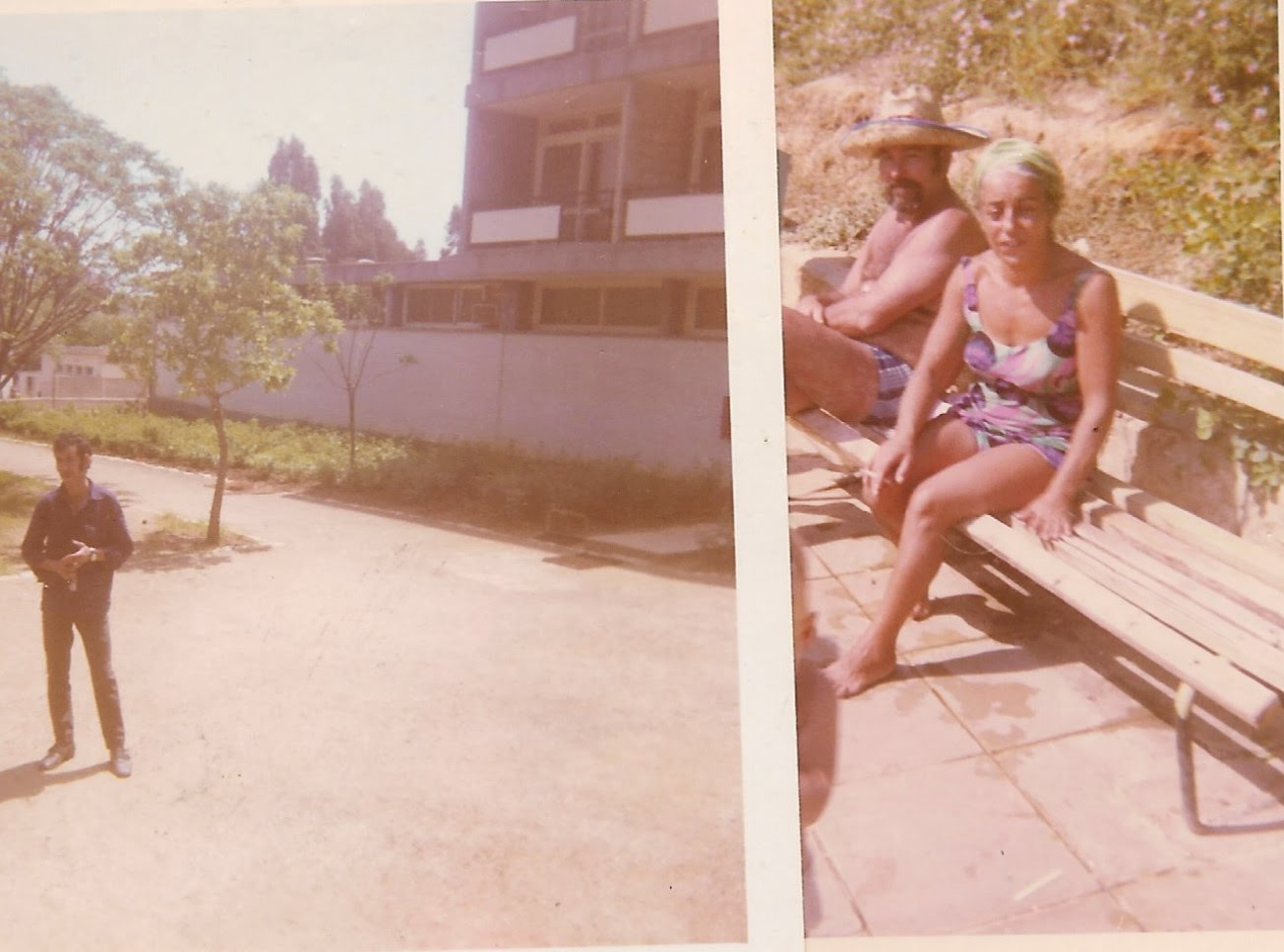
Kiryat Shmona (literally, “the town of the 8”) is a development town established in the 1950’s in a place the Israelis call the “finger of the Galilee” located in the most northern part of Israel, not too far from the Lebanese border. It was named after the 8 people who were killed, including Israeli hero Joseph Trumpeldor, by a mob of Arab militia in 1920 when they overran their agricultural settlement in nearby Tel Hai. It was settled mainly by immigrants from North Africa. In the above right photo are Sami Mordo and his wife Maria in 1970. Sami was an immigrant from Alexandria, Egypt and his wife, Maria was from Morocco. They had 3 daughters in Kiryat Shmona – Naomi, Tony and Shirley and a young son, Rafi. During Rosh Hashanah in 1970 Sami sent his daughters down to the ulpan (“studio” for Hebrew language training) pictured in the above left photo with the purpose of inviting 2 random volunteers from the Sherut La’am program to join them for the holiday dinner. It just happened that those 2 random volunteers were Patersonians. In 1981, Maria's sister, Perla, her husband Emil, an ambulance driver in Kiryat Shmona, and their 2 children, moved to Fair Lawn. The man in front of the ulpan is Yaakov Abukassis, the custodian of the ulpan at that time. The town has suffered periodic bombardments of katyusha rockets from Lebanon in years past. The town currently has a population of about 20,000 and is being evacuated this week because of the serious threat of an incursion by Hezbollah terrorists from Lebanon. Israeli soldiers have been killed this week in skirmishes with Hezbollah along their northern border.
As we mentioned last week, in 1976 Yamit was an Israeli planned community that was first populated by Russian and American contingents as well as some career military personnel who were stationed at the new air force base nearby. It was located along the coast just south of the Gaza Strip but was evacuated in 1982 and demolished soon after that in the wake of the peace treaty with Egypt following the Camp David Accords.
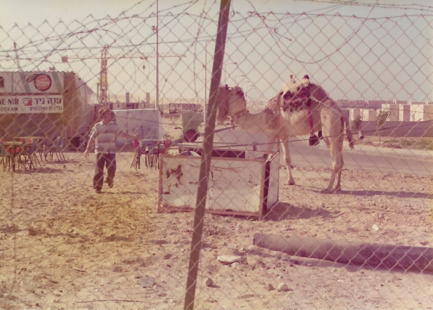
An enterprising Israeli, known as the “Gingi” and pictured in the upper left image opened a snack bar to feed the workers then building the town. He also offered camel rides to visitors. The former location of the town is very close to where the borders of Egypt, Israel and the Gaza Strip now meet, in proximity to the Rafah Crossing, which has been in the news this past week due to its strategic location. It is one of the two official corridors in and out of Gaza. 2 Fair Lawn residents were among the American contingent who founded the town of Yamit. The image on the right is a destroyed train, a remnant of an earlier war, left to rust in the Sinai desert south of Yamit along the coast on the way to El Arish in Egypt.
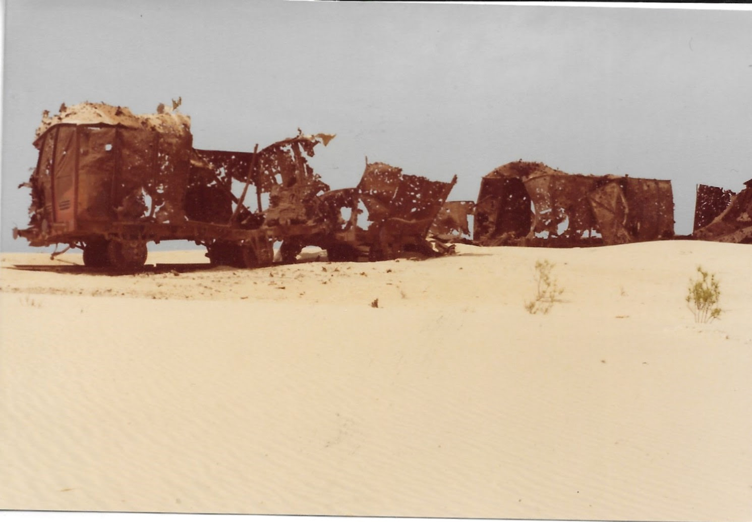
The image on the right is a destroyed train, a remnant of an earlier war, left to rust in the Sinai desert south of Yamit along the coast on the way to El Arish in Egypt.
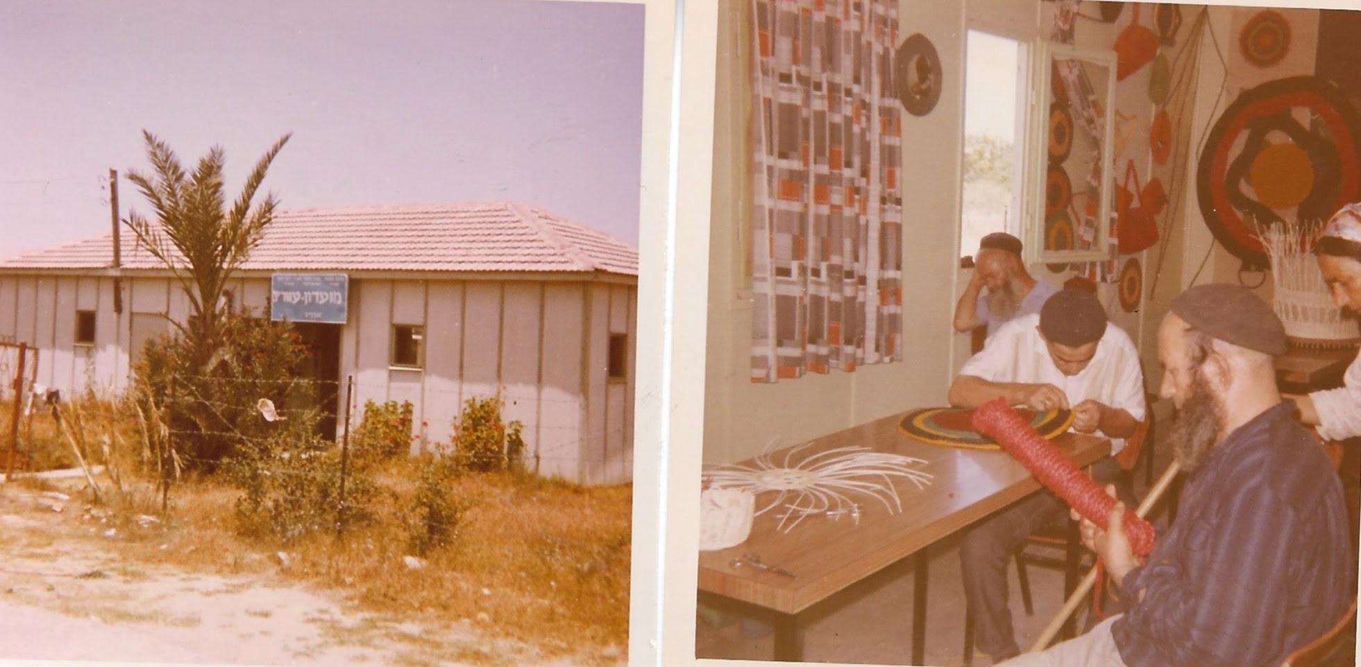
Ofakim is a development town settled in the mid-1950’s by Mizrahi Jews mainly from Morocco, Tunisia and Iran. It is about 25 kilometers from the Gaza border. The left image above is the club building for the blind in Ofakim. In the above right image, blind Okakim residents make baskets and other useful items to support themselves and the club. The images above were taken in 1970-1971 by 2 Patersonians while on a volunteer year with the “Sherut La’am" program. At least 30 Ofakim residents were murdered in the Hamas incursion of October 7th.
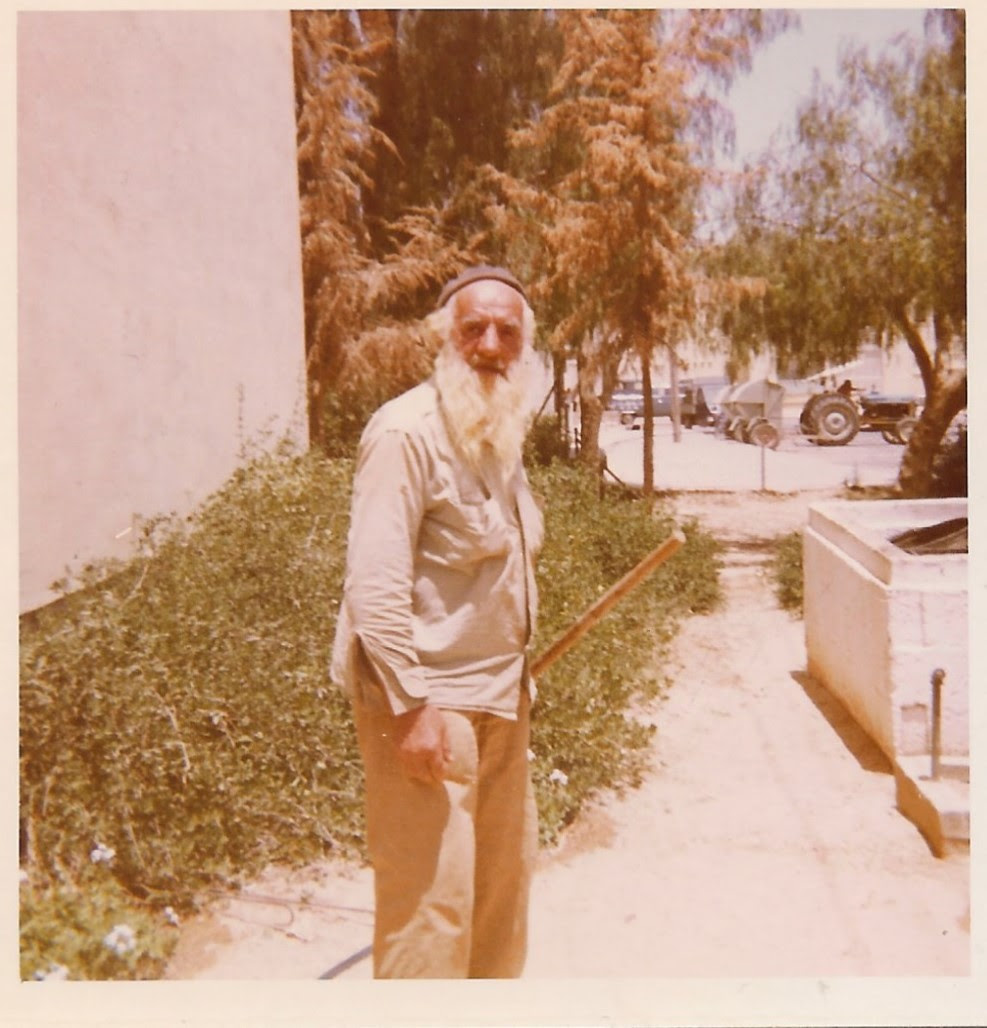
The gardener/landscaper outside the building housing the Paterson volunteers in Ofakim in 1970.
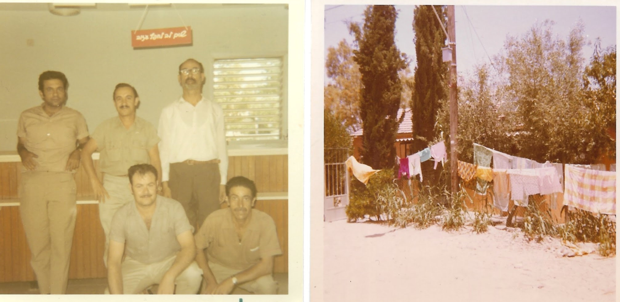
The above left image is of the Ofakim Post Office staff in 1970. There weren't many clothes driers in Ofakim in 1970. The above right was the common way for residents to dry their clothes. The images were taken in 1970-1971 by 2 Patersonians on a volunteer program.